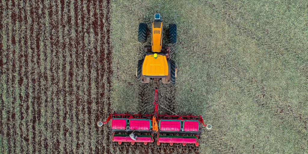
Many Agtech startups use remote sensing technology for a variety of farming applications. The use of drones and airplanes is becoming more common to provide field-level analysis. As is using globally available satellite data for large-scale analysis. Satellite data can also be combined with field information to create a complete picture of what's happening on the ground.
Agtech companies are also busy developing advanced artificial intelligence (AI) systems to support the collection and interpretation of large amounts of data. All of this work can allow growers to make sense of what is happening with their farms and crops.
This article offers an overview of remote sensing technology in agriculture, and some of the companies at the head of these advancements.
What is Remote Sensing in Agriculture?
"The collection of information about items or locations without having direct interaction is referred to as Remote Sensing" - Trends in Remote Sensing..
Remote sensing in agriculture collects information about the Earth's surface from above. Instruments are designed to sense and record reflected or emitted energy from the ground. It then feeds this data to a computer or a group of human analysts to process, analyze, and apply that information.
The most frequent use of remote sensing technologies in orchards include satellites, drones, multi-type sensors, and vigor evaluation.
Remote sensing uses photography. This is different from most other smart sensors in agriculture that use mechanical data collection devices with some wireless connection. You can read more about these other types of remote sensors in agriculture.
How is Remote Sensing Applied in Agriculture?
In recent years there have been a lot of advancements in remote sensing. To process large amounts of information remote sensing collects, AI systems are also developed to make complex data useful to growers.
New applications are being tested in orchards and fields from seed to harvest. Growers are able to gain insights into the growth and productivity of their cash crops from year to year.
Different crops may have different needs in terms of remote sensing. This includes specific coverage areas and the specific equipment needed.
Benefits of Using Remote Sensing Technology in Agriculture
Environmental Monitoring
Remote sensing has long been used to collect and analyze weather data to make predictions and track long-term changes. Data collected from remote sensors can monitor the environmental health of small and large regions around the world
At the farm-level, remote sensing is focused on what's being grown today. Several companies are also using this tech to protect farms from extreme weather.
Monitoring Snowpack and Water Levels
Remote monitoring is one of the best tools for monitoring drought, snowpack, flooding, and water storage capacities without putting boots on the ground. This provides valuable data for water managers and decision makers.
Yield Prediction
Aerial photos help create maps that provide a detailed account of crop production and the potential revenue of a field or orchard. International agriculture companies use this to keep an eye on foreign commodity crops. Orchard managers can also use this data to help make decisions about what is profitable, and what is not worth their time when it comes to harvest time.
Vigor Assessment
In many cases, sensors can detect problems such as pests or diseases in the orchard before they are visible to a trained worker. Germination rates, propagation, grafting success, and even chlorophyll can be measured from afar. NASA developed the Normalized Difference Vegetation Index (NDVI) to measure leaf density from space. This tech is trickling down into common use, which means it's getting cheaper and more effective every year.
NASA says, "To determine the density of green on a patch of land, researchers must observe the distinct colors (wavelengths) of visible and near-infrared sunlight reflected by the plants."
What is the Future of Remote Sensing in Agriculture?
The future of remote sensing is changing quickly. Technological advancements in machine learning, AI, digital image processing, and satellite detail are defining the field. Plus, smartphone integrations are likely to become more and more beneficial to the farm and orchard manager.
The cost of technological innovation drops as solutions improve. This means in the future, small and medium sized growers will have access to these affordable remote sensing tools.
Applications of Remote Sensing in Agriculture
The applications of remote sensing technology in agriculture are changing daily. Here is a short list of some of the main applications of remote sensing in agriculture. Keep in mind that these are just some of the things that can be done with these hi-tech cameras.
- Satellite Imagery
- Weather Data
- Soil Moisture
- Irrigation Monitoring
- Live Equipment Monitoring
- Crop Health Change Detection
- Crop Vigor Assessment
- Aerial Data Collection Via Unmanned Drone
- Aerial Data Collection Via Airplane
- Multispectral Sensors, Multispectral Imagery
Top AgTech Companies Using Satellites for Remote Sensing
- Descartes Labs has a set of tools to analyze and monitor crops from public data that satellite imagery captures. With this tech, they monitor crop health and yields, forest loss and illegal land use. As well as find and establish boundaries of fields and crop types for whole continents.
- Geo SYS's EarthDaily Constellation provides images of the globe and data for weather and integration with custom information to monitor plant health.
- Planet Labs uses satellite imaging with field-level detail on a global scale to measure crop health from pre-season to harvest.
Promising Tech Companies that use Drone or Airplane Based Data
- Parrot, one of the largest producers of consumer drones, has a whole company division dedicated to agricultural applications.
- Ceres Imaging specializes in collecting multiple types of images with airplanes to help farmers increase yields by detecting water stress and tree leaf color.
- IntellinAir uses planes and drones to collect multispectral imagery analytics to find problems before the human eye can detect them.
- Slant Range aerial drone-based solutions to analyze plots for leading seed, crop protection, and nutrition suppliers.
What does this mean to me?
Agriculture has become the proving ground for the collaboration of many tech sectors, and the playground in some cases. It is exciting to be at the front of all these innovative technologies operating in the fields and skies above farms and orchards.
For small and medium sized businesses, critical satellite and weather data captured through remote sensing have been used in four key areas.
- environmental monitoring
- monitoring snowpack and water levels
- yield prediction
- vigor assessment
Future technologies will likely be built on these four areas. As well, they will integrate more of the data on the environment of critical growing regions around the world.
References:
- Trends in Remote Sensing Technologies in Olive Cultivation, Smart Agricultural Technology, Volume 3, 2023, 100103, ISSN 2772-3755, https://doi.org/10.1016/j.atech.2022.100103. https://www.sciencedirect.com/science/article/pii/S2772375522000685
- https://techcrunch.com/2020/01/22/descartes-labs-launches-its-new-platform-for-analyzing-geospatial-data/
- https://medium.com/remote-sensing-in-agriculture/remote-sensing-market-map-20-remote-sensing-startups-and-the-varied-data-that-fuels-them-36d8ee97f66f
- https://www.tractorjunction.com/blog/types-of-smart-sensors-in-agriculture-for-farming-in-india/
- https://earthobservatory.nasa.gov/features/MeasuringVegetation/measuring_vegetation_2.php
Croptracker develops agtech solutions for industry leaders. Located in Eastern Ontario, Canada, our mission is to make crop production safer, more efficient, and more profitable. Designed in partnership with fresh market producers and distributors, every tool we create is based on direct industry feedback. Croptracker’s award-winning farm software optimizes recordkeeping, labor tracking, production and cost management. Our integrative Harvest Quality Vision technology offers instant empirical analysis of crop samples exactly when you need it. Optimize your harvest season with Croptracker’s customizable solutions. Visit Croptracker.com to learn more about our products and contact us for app based solutions.